 Photos © Ruud Leeuw
 Photos © Ruud Leeuw
 Early hours at Toronto-Pearson Int'l Airport...
We got up at 5 a.m. to catch our early Westjet flight to Winnipeg. We had a hard time finding the airport in a dense morning fog and missed the highway exit... We took the next exit, lost our sense of direction in the eerie fog-filled darkness, could not find the way back until I asked a busdriver who pointed out an unmarked ramp (work in progress)... Thanks man, still grateful ! The strike with Thrifty / Dollar carrental was ongoing, but someone (management?) offered to park our car and we made it in time to the gate. But obviously we weren't the only ones feeling the hardship of modern travel ! |
 Westjet flight WJ659 19Sep07, Toronto to Winnipeg, on time.
My flights in 2006 with this company went well and I found their rates competitive, so this year for the return trip to YYC - YWG we booked Westjet again.  The flights went well, but it is very likely my camera tripod got damaged on this particular flight: some protruding parts were bent and rendered the tripod useless (in fact it proved to be damaged beyond repair). Probably something heavy (the suitcases some people lug along!) was thrown on my suitcase. The flights went well, but it is very likely my camera tripod got damaged on this particular flight: some protruding parts were bent and rendered the tripod useless (in fact it proved to be damaged beyond repair). Probably something heavy (the suitcases some people lug along!) was thrown on my suitcase.In part I have myself to blame, as I learned I could have taken the protruding parts off... A lesson learned. |
 |
 |
 |
| Looking down we noticed the scenery change from 'bush', to more agricultural and finally there was Winnipeg. |
 We hadn't really looked for bookstores in Toronto, but now we were looking at many miles on the road and we decided this was the time to stash our bags and shop for books: Chapters. |
 The nice thing with large bookstores in the US and Canada is they have coffee corners and a place to sit down and browse through the 'winnings'...
We bought some books and CD's here. Nearby we bought more CD's at Best Buy and a few t-shirts in The Bay store. |
 Initially we went to the same hotel as the one we stayed with in Toronto (Oakville), the Country Inn & Suites, but they were fully booked. So were the other hotels in the vicinty of the airport.
 We drove to Portage Avenue and continued onto the Trans Canada Highway to the edge of town. We found a room in the Howard Johnson Express. |
 I wasn't too impressed with this hotel: it had a definite tacky appearance. But I managed to get wireless internet here on my laptop: a first for me and a new style of travel. The adjoining 'diner' in the back of the hotel was basic, but had good food and as hotel guests we got a discount. We like those "truckers's cafe"-style locations, provided they do good food. |
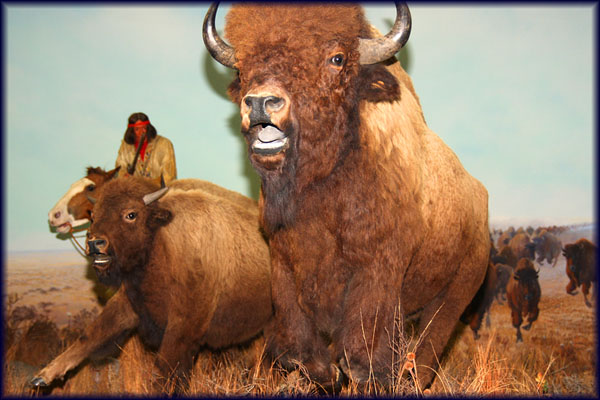
We visited the Manitoba's Museum of Man and Nature: very impressive and rewarding!! Here is an impression on a seperate page . |
 The third day started with rain too, so we headed out west, on the Trans Canada Highway 1A / Portage Avenue. This is a random photo in Portage la Prairie, the first big town on Hwy 1A and at the corner of Tupper Street (Route 240). |
 Our route, driven in 7 days. |
 We woke up and faced the same kind of weather as yesterday: clouds, wind & rain. We cancelled our plans to see more of Winnipeg and headed out west for Highway 1. We woke up and faced the same kind of weather as yesterday: clouds, wind & rain. We cancelled our plans to see more of Winnipeg and headed out west for Highway 1.In Portage la Prairie, a name resounding the history of the fur trade (on which subject I again had bought a book), we decided Tim Horton's would be a good stop for coffee and morning snack. |
 While we continued west, the weather quickly improved and soon we were looking at blue skies. In Brandon we visited a museum and we stayed the night in Virden. |
|
 We entered Saskatchewan on Highway 1 and the first of the grain silo's were spotted, first of many. |
 When we started from Virden it was sunny, but only +4 C. When we started from Virden it was sunny, but only +4 C. We faced a long drive and roadmusic is important. Fred Eaglesmith, singer/songwriter from Ontario, is a recent 'discovery' of mine and I had bought 3 CD's. The music seemed particularly fitting for the scenery we drove through. Later on we started listening to XSM Satellite Radio, which had channels for my taste of music, alt.country, too. In Moose Jaw we visited the Transportation Museum. |
There is plenty to see on the road. |
 |
 |
 Old sheds and derelict buildings are for me nice subjects to photograph too.
|
 Always fun to see the name of a relative signposted! |
 |
 The Canadian prairies is a large area of flat sedimentary land stretching throughout western Canada between the Canadian Shield in the east and the Canadian Rockies. The Canadian prairies the portion of the Great Plains landform that supports various grasses and shrubs cover much of the provinces of Manitoba, Saskatchewan, and Alberta a region known as the Prairie provinces, Canadian Prairies, or simply the Prairies.
 The Canadian prairies are one of the world's major farming areas. Two of the most important commodities are wheat grown in the southern prairies and beef cattle raised in Alberta and Saskatchewan. Further north, sheep are often raised. Source: Wikipedia |
 The railway is a frequent companion to the highway... The railroad made me remember a singer/songwriter who set my taste in the 1970s to that particular kind of music: Gordon Lightfoot.
The "Canadian Railroad Trilogy" is a song by Gordon Lightfoot that describes the building of the Canadian Pacific Railway. It appeared on Lightfoot's The Way I Feel album in 1967 along with the song "Crossroads", a shorter song of similar theme. In the first section, the song picks up speed like a locomotive building up a head of steam. While Lightfoot's song echoes the optimism of the railroad age, it also chronicles the cost in sweat and blood of building "an iron road runnin' from the sea to the sea". Source: Wikipedia |
| Saskatchewan has an area of 588,276.09 square kilometres and a population of 990,212 (according to 2007 estimates), mostly living in the southern half of the province. Of these, 202,340 live in the province's largest city, Saskatoon, while 179,246 live in the provincial capital, Regina. Other major cities, in order of size, are Prince Albert, Moose Jaw, Yorkton, Swift Current, and North Battleford. The province's name comes from the Saskatchewan River, whose name comes from its Cree designation: kisiskaciwani-sipiy, meaning "swift flowing river". Source: Wikipedia |
 |
 |
| Grain elevators are a common sight in the grain-growing areas of the world, such as the North American prairies. Larger terminal elevators are found at distribution centers, such as Chicago and Thunder Bay, Ontario, where grain is sent for processing, or loaded aboard trains or ships to go further afield. Grain elevators are buildings or complexes of buildings for storage and shipment of grain. They were invented in 1842 in Buffalo,NY by Joseph Dart, who first developed a steam-powered mechanism, called a marine leg, for scooping grain out of the hulls of ships directly into storage silos. Older grain elevators and bins often were constructed of framed or cribbed wood and were prone to fire. Grain elevator bins, tanks and silos are now usually constructed of steel or reinforced concrete. As grain is emptied from the elevator's bins, tanks and silos it is conveyed, blended and weighted into trucks, railroad cars, or barges and shipped to end users of grains (mills, ethanol plants, etc.) Source: Wikipedia |
 Nearing the end of a driving day, looking for a bed, food and wireless internet.
|
 Many of the roads, exiting Highway 1, are gravel- or dirt roads. Many of the roads, exiting Highway 1, are gravel- or dirt roads.The prairieland is flat, a feature common to my country. But due to the lack of buildup areas, one can see for miles here and that creates SPACE! Just what the doctor ordered... |
| Today, the Sioux maintain many separate tribal governments scattered across several reservations, communities, and reserves in the Dakotas, Minnesota, Nebraska, and also in Manitoba and southern Saskatchewan in Canada. |
 This is at Sintaluta, not far from Indian Head. The next big town is Regina, 85 kms west on Highway 1. Sitting in the car, seeing the country pass us by mile after mile, after mile... one gets a feeling of endless motion: the road goes on forever. |
 |
 I think this part of town isin Regina; we went to the RCMP Heritage Centre, but found the plane I had come to see not included in the new museum, so we cancelled our visit and moved on: another museum to visit in Moose Jaw.
|
| The countryside suddenly changed considerably, like we were on another planet..
Potassium comes here to the surface and is responsible for this un-earthly looking landscape. |
 |
 |
| Potassium is a chemical element, the name comes from the word "potash", as potassium was first isolated from potash. Potassium is a soft silvery-white metallic alkali metal that occurs naturally bound to other elements in seawater and many minerals. It oxidizes rapidly in air and is very reactive, especially towards water... The principle source of potassium, potash, is mined in Saskatchewan, California, Germany, New Mexico, Utah, and in other places around the world. 3000 feet below the surface of Saskatchewan are large deposits of potash which are important sources of this element and its salts, with several large mines in operation since the 1960s. Saskatchewan pioneered the use of freezing of wet sands (the Blairmore formation) in order to drive mine shafts through them. Source: Wikipedia |
 |
 A bleak, dismal evening in Swift Current. Shall we eat out or order a pizza? |
 I love it when these grain elevators show the marks of time... The rain-sodden access road adds to the atmosphere.
|
 |
 |
| A long drive in the rain, a visit to a museum in Nanton and the day ended in Calgary where we checked in with the Country Inn & Suites. An evening of organizing the photos on the laptop, doing some webmail (my webhost Midphase had temporarly pulled the plug on my website due to excessive, but brief peak, of visitors and I vented my anger by email to Midphase; fortunately things were restored to normal) and watching some tv (our favourite sitcoms e.g. Seinfeld amd Frasier). Walking to the nextdoor diner almost we almoste ended up in a ditch... They just don't plan for people on foot. The only reason we were in Calgary was because I wanted to meet someone, we did not visit the town. The next morning we had frost on the car (-4 C), but it turned out to be a warm, sunny day. |
 North of Calgary and Red Deer, the area of Lacombe. We stayed with friends there. |
 |
 |
| The area has countless Dutch farms and those black & white cows certainly looked very familiar. The Dutch Mill in the garden gives away the roots of the Egginks. It takes courage to start anew in another country, in my opinion. |
 Driving in easterly direction, on Route 12, we soon came across this Buffalo herd. A little bit further to the east is Buffalo Lake, so that would fit... |
 We stopped for some coffee, took it with us as we had a long drive ahead of us: to Saskatoon. |
 |
 |
 The roads in Saskatchewan have a certain reputation... We drove Route 51. Actually, Saskatchewan has a reputation of its own: some refer to it as 'The Gap'! Winters can be extremely cold, and when combined with heavy snowfall and wind, blizzards can make driving dangerous. Many of Saskatchewan's highways have been poorly maintained, and when combined with icy pavement or heavy traffic, they can be dangerous for inexperienced or inattentive drivers. Many rural roads are unpaved. Source: Wikitravel |
A JOKEAn American couple is standing in an airport terminal somewhere in the States, waiting for their luggage. The wife happens to notice an oddly dressed man also waiting. She asks her husband where he thinks the man is from. The husband says he doesn't know. He decides to ask the man and approaches him. "Where are you from ?" he asks the man. "Saskatoon, Saskatchewan" he replies. Puzzled, the husband returns to his wife. "Well, where is he from?" asks the wife. "I don't know" replies the husband. "He doesn't speak English." 
|
 This is the Blue Horizon Cafe and Gas Bar, somewhere along Route 51 or Route 14, probably less than an hour or so away from Saskatoon. We had a quick lunch here. This is the Blue Horizon Cafe and Gas Bar, somewhere along Route 51 or Route 14, probably less than an hour or so away from Saskatoon. We had a quick lunch here. I needed to confirm my appointment in Saskatoon, but had to use a landline here because my mobile phone could not find a network while we drove through these parts. |
 Another very large potassium plant in the distance, marking the horizon. Another very large potassium plant in the distance, marking the horizon.The Saskatchewan potash industry began in the 1950s and 1960s. The government saw it as a promising new field and granted large subsidies to the new projects, mainly by American companies. However, this led to overproduction and when a global potash glut began in the late 1960s the industry almost collapsed. The Liberal government of the province introduced an emergency plan setting up quotas and a price floor in 1969. This plan was popular among the companies, which could now charge monopoly prices. The NDP government that was elected in 1971 in Saskatchewan was dissatisfied with this plan as the huge profits went to the companies rather than the government, and it wasn't sustainable in the long term. In 1974 the government passed a new potash regulation scheme, that included a reserve tax. This plan was resisted by the potash producers, and its constitutionality was challenged. Thus in 1975 the provincial government established the Potash Corporation of Saskatchewan as a government crown corporation. Source: Wikipedia |
| A series of grain elevators. As of August 1, 2006, there were 337 licensed primary elevators in western Canada: Manitoba - 72, Saskatchewan - 179, Alberta - 82 and British Columbia - 5. The census of 1986 numbered 1860 ! The term "primary elevator" was not used until the 1971-72 crop year. It replaced the term "country elevator". Historical data show that in 1933-34, there were 5485 public and private licensed country elevators in western Canada. This was the crop year that had the highest number. Source |
 |
 |
 |
 |
 |
 |
 |
 Churches like these are a common sight, I had noticed many during my 2006 visit to the area of Edmonton. The first Ukrainian settlers came to Canada in the year 1891, followed by a large influx between 1897-99. |
 |
 |
| We stayed the night in Dauphin,Manitoba and the next morning we made a scenic drive through beautiful Riding Mountain National Park. This area has also a history in the Fur Trade. While researching the history of the trade with the Indians, the impact of colonisation and wars had on them, I came across a link with the Dutch in the French and Iroquois Wars a.k.a.the Beaver Wars. |
| A few more dwellings caught on camera. |
 |
 |
|
One noteworthy thing was being stopped for speeding driving on Route 68: I was still on the Saskatchewan speedlimit (110 km/hr, adding a little extra to that..) and did not realise Manitoba had a speedlimit of 100 km/hr. I was caught doing 124. Fortunately, the police officer was understanding and I got away with a warning. A fine would have cost me over 200 dollars. We stayed in Gimli, in a much overpriced hotel. Never mind the sunset over Lake Winnipeg. |
 |
 |
 This is just outside Gimli, heading south on Route 8. We continued east on Route 44. |
 Gas and food, what more do you want? Fireworks we leave for another day. Next we crossed the border of Ontario, entering the 'Canadian Shield'. |
| MORE LINKS:
University of Saskatchewan Archives: The Changing Face of the Saskatchewan Prairie. Grain Elevators of Saskatchewan by Mike Stobbs on Pbase.com www.grainelevators.ca/gallery Inventory of Existing Grain Elevators in Saskatchewan (pdf) Manitoba Historical Society |
Other pages dedicated to this vacation:
Toronto
Northwest Ontario
|


