After our arrival at Seattle's Sea-Tac airport we noticed it was 13:00 local time (though nine hours later in Amsterdam), and what does one do at that time ? Lunch, that's right !
So after we collected the car we went straight to BurgerKing, for a juicy whopper....
We'd not had one in years (McDonalds and BurgerKing did not have their franchise started in the Netherlands then)
and felt satisfied getting reacquainted. Just as good as in 1983.
The weather was excellent: a balmy 25 C (76 F ). We decided to clear the city limits for the Snoqualmie National Forest, where we pitched our tent at the Silver Springs Campground.

Although we hadn't yet completed our camping gear (we didn't even bring matches), we decided to pitch our tent
at this nice campsite (which was filling up fast), next to a fast flowing river. Back to Nature..!
When we arrived at Silver Springs Campground, we found that the Mobil Camping Guide had us wrongly informed: there was no store! Having left the city in a hurry, and only having brought a tent and sleeping bags, we found ourselves without food, drinks, matches for a woodfire, no cups for water to hold....
Camp fee was only US$6,-
Well, since it was 20:00 by the time we were done with our tent, meaning 05:00 for our body clocks, we decided to call it a day and went to sleep. Sure glad we had eaten those big hamburgers earlier that afternoon !
It sure felt nice to be here, even better after we broke camp and went for a nice breakfast!

Our first 'American breakfast and we sure were hungry & cold!
Out on the road
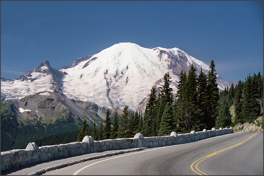
Mount Rainier may look cold but the sunshine brought warmth.


Mount Rainier stands as an icon in the Washington landscape. An active volcano, Mount Rainier is the most glaciated peak in the contiguous U.S.A., spawning five major rivers. Subalpine wildflower meadows ring the icy volcano while ancient forest cloaks Mount Rainier’s lower slopes.
www.nps.gov/mora/
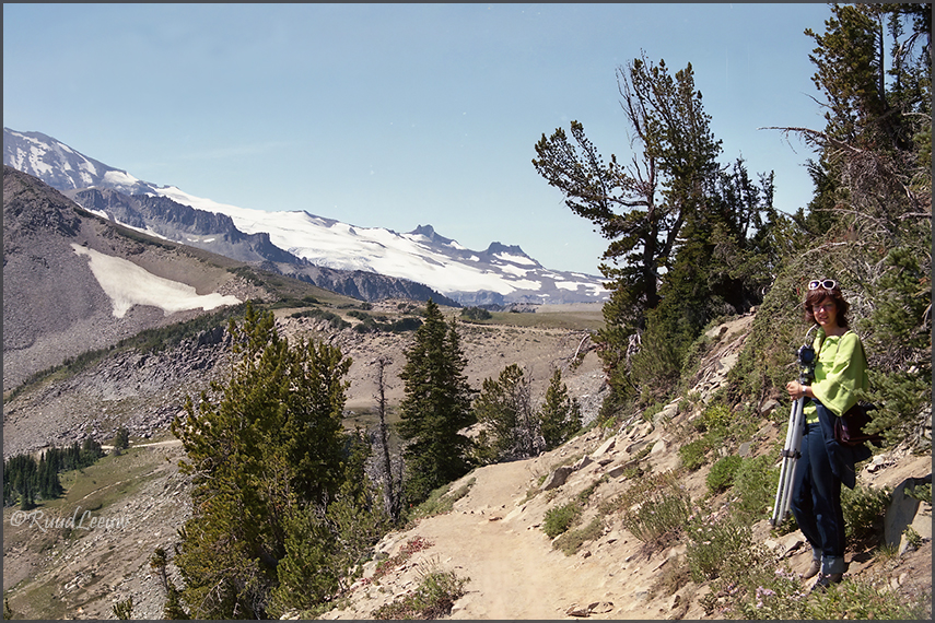
Hitting the trails, see if we can make it to the snow

Macho on the snow

On a clear day one can see forever!
Little did we suspect that the August nights could be just as cold... We found our sleeping bags required us getting dressed again to conquer the shivering during the night. We also noticed how pitchdark it could be between all the gigantic trees and of course we had not thought of bringing a flashlight with us.
Hungry and cold, we had out first US breakfast with Crystal Mountain Sky Resort and that brought us back on our feet.
We had a good hike at Mt. Rainier (a volcano covered with glaciers), the trail not being too hard on us. I took lots of photos and we took our time, still feeling a bit hungover from the jetlag and the uneasy night. We commented how things would have been different had we brought our son, aged 2 almost, with us.
|


On a coffee break, Ada guarding my camera gear.
On this trip I still had my Hasselblad, which proved to be too ambitous for this photo amateur (I could not afford
a single item except the camera, lens and filmcassette).
I also had a Nikon FM-2 and an Olympus OM-1 with me. Photography on these vacations has always been important for me, taking my time with a tripod and shooting many films. |

Mount Rainier National Park visitor center
After the hike we drove east, to Richland, to visit a friend we had met on the Kenya trip (1985).
Along the way we bought some of the items we had found lacking in our campinggear.

Jean Callen @Richland, we enjoyed her kind hospitality. A happy spirit, R.I.P.
|


 Campgrounds in the US were a revelation to us: so much space, distance to other campers, freedom of movement, barbecue pit on every site, often a picnic table.... wow!
 View over Jackson Lake, at first light in the morning. I needed my tripod to make this photo. It sure was cold too..